We may earn revenue from the products available on this page and participate in affiliate programs. Learn More ›
Made in America

From the Empire State Building to the Grand Canyon, America has countless iconic sites within its borders. Gain a greater appreciation for our nation’s history, natural beauty, and architectural wonders by visiting these 25 destinations right here in our 50 states.
Yellowstone National Park in Wyoming
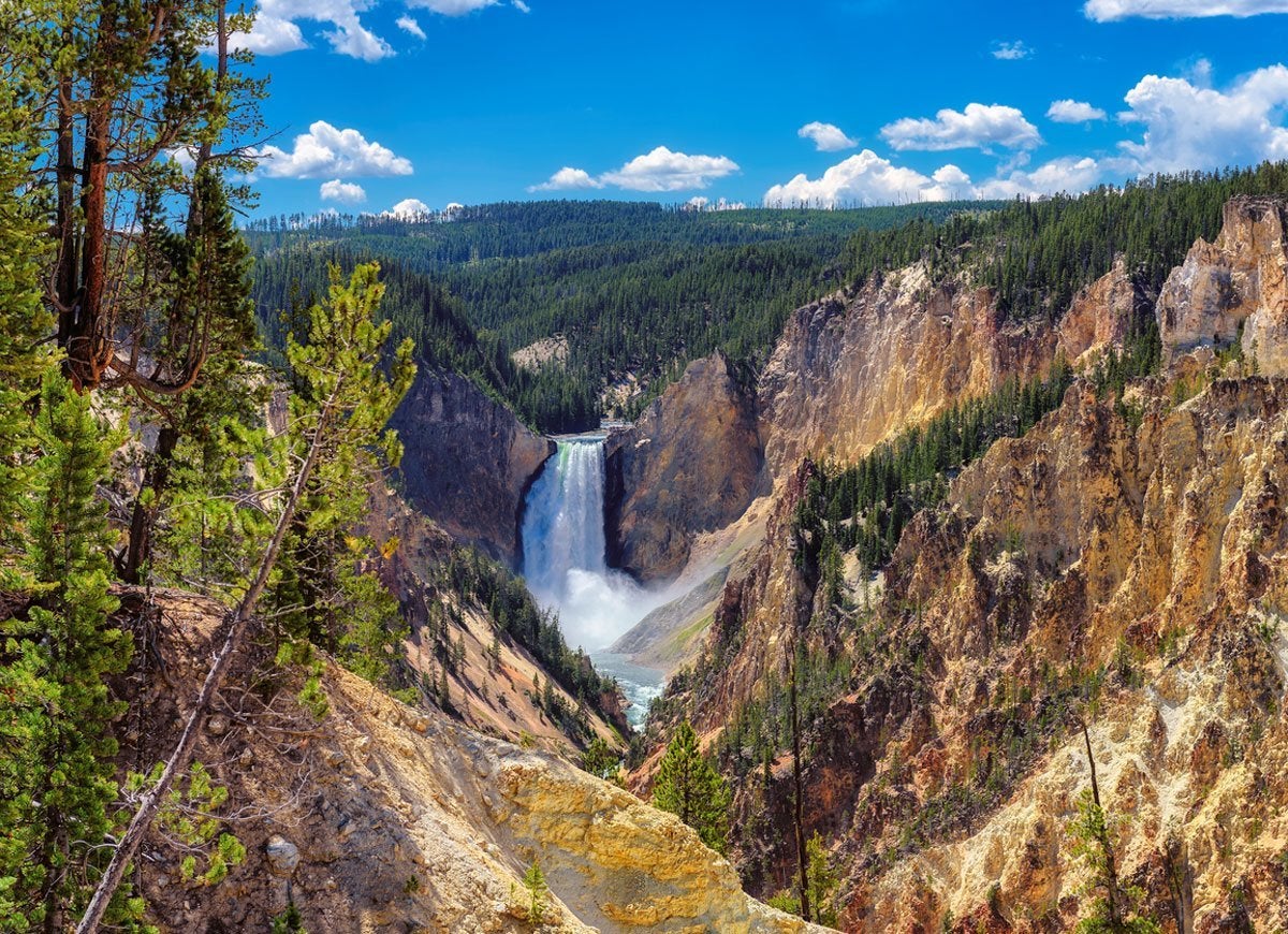
Established in 1872 by President Ulysses S. Grant, Yellowstone actually stretches across parts of Wyoming, Montana, and Idaho. Visit this stunning gem, our country’s first national park, for its mountains, hot springs, geysers (including iconic Old Faithful), and wildlife like grizzly bears, bison, wolves, and elk.
Grand Canyon National Park in Arizona
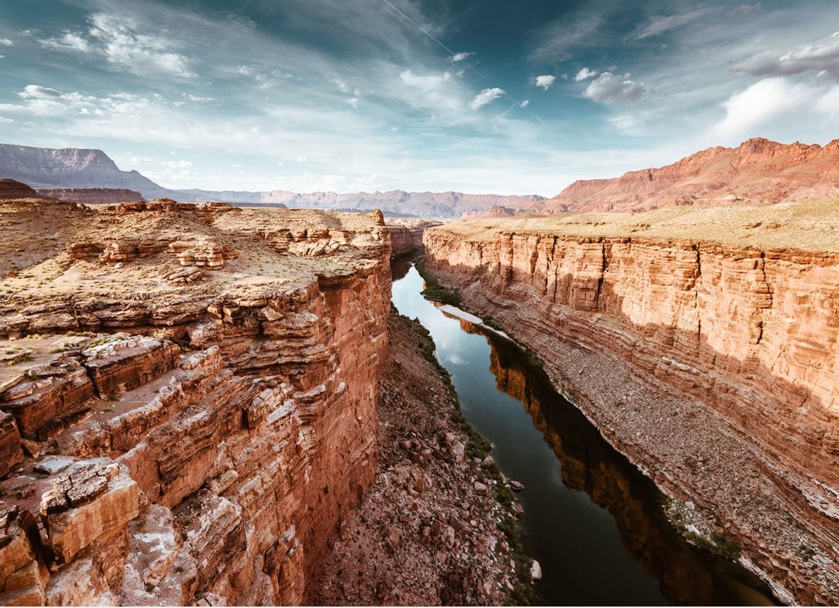
There’s a reason why millions of people visit the Grand Canyon every year. The mile-deep gorge in Arizona is one of the Seven Natural Wonders of the World. Visitors can explore this ancient geological marvel through hiking, biking, rafting, helicopter rides, mule tours, and more.
Related: 25 Tiny Towns to Visit for a Glimpse at How We Used to Live
Crater Lake in Oregon
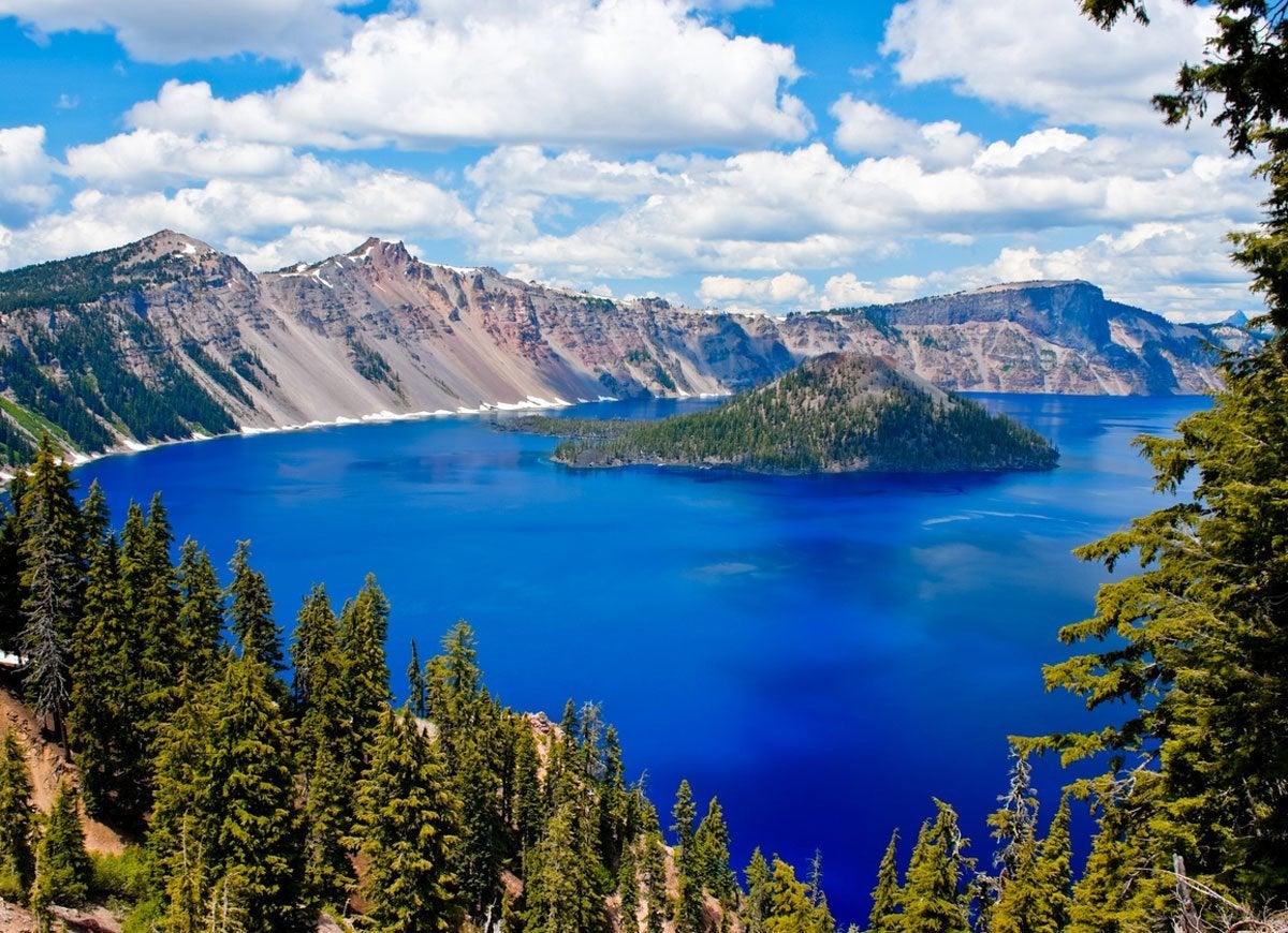
Pure beauty and awe collide at your first sight of Crater Lake in Oregon. Intensely blue water fills a caldera that was formed by the collapse of a volcano thousands of years ago. The deep blue color of the lake, which is sacred to the Klamath tribe, hints at its impressive 1,949-foot depth, which makes it the deepest lake in the United States. Visit in the winter for skiing, snowboarding, snowshoeing, sledding, and cold-weather activities. Those who prefer warmer amusements can opt for a summer vacation filled with hiking, biking, swimming, and boat tours.
Carlsbad Caverns in New Mexico
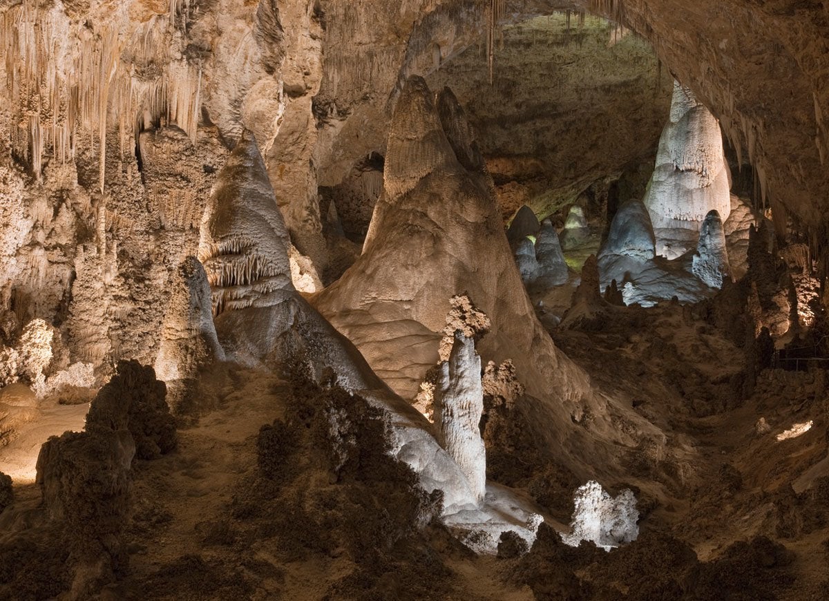
Under New Mexico’s Chihuahuan Desert lies Carlsbad Caverns, a cave system filled with chandeliers and temples built of glistening mineral deposits. Choose between self-guided tours and ranger-guided tours of the cave—and if you visit from May to October, be prepared to witness the spectacular flight of bats at twilight.
Related: 12 Destinations You Should Actually Visit During the Off-Season
Mesa Verde National Park in Colorado
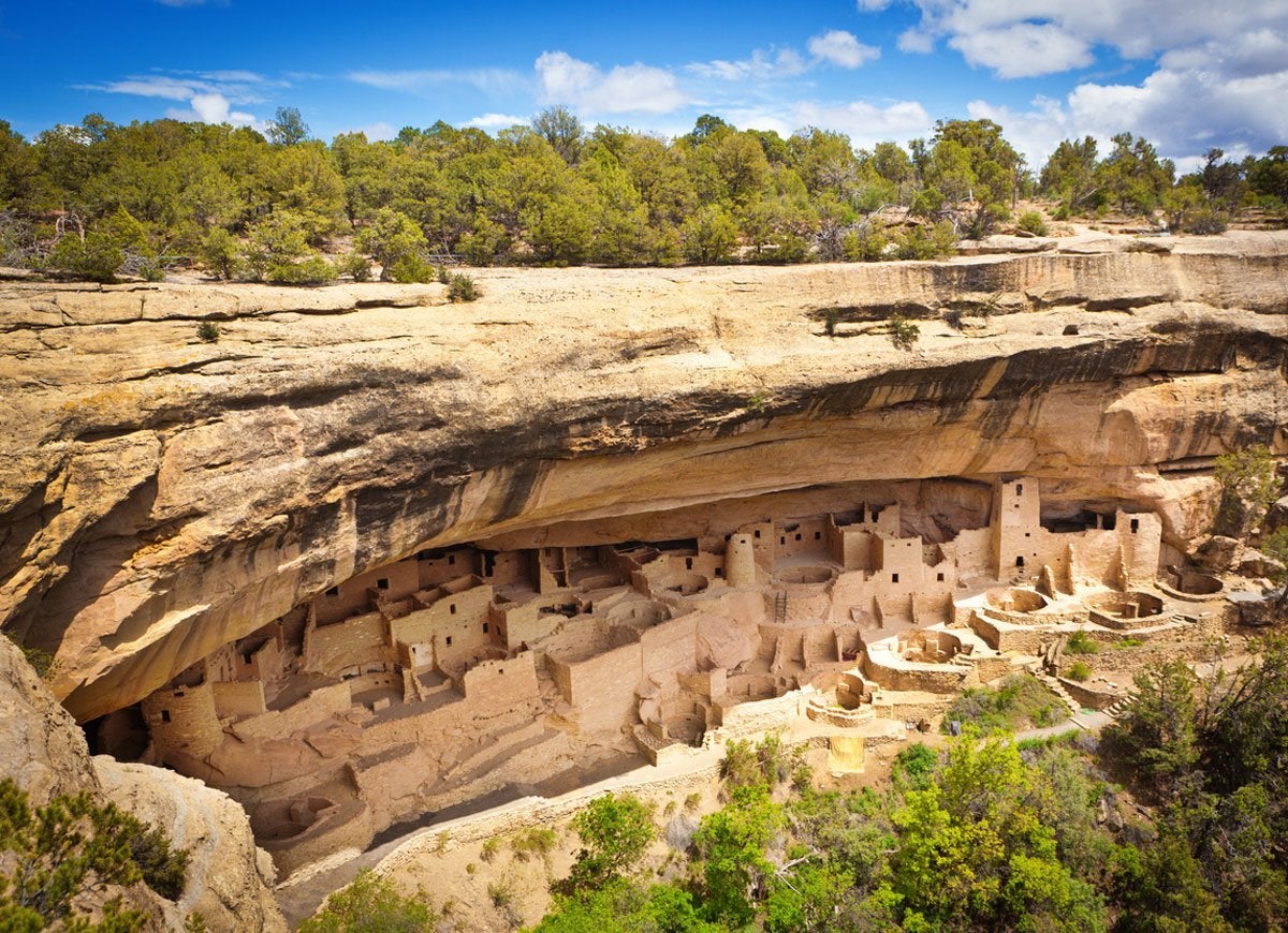
American history stretches back far beyond 1776. At Mesa Verde National Park in Colorado, you can learn more about the ancient cultures who once called this land home. Some of the best-preserved archaeological sites in the Americas, including cave dwellings of the Ancestral Pueblo people, sit within the 52,485-acre park.
New York City

Iconic landmarks abound in New York City, including the Metropolitan Museum of Art, One World Trade Center, Central Park, Times Square, the Statue of Liberty, the Empire State Building, and so much more. Spend some time at the must-see tourist destinations, then live like a local by diving into New York’s world-famous culinary and cultural scene.
Related: 20 Beautiful Homes Hiding in America’s Most Affordable Cities
The Smithsonian Institution in Washington, D.C.

The Smithsonian in Washington, D.C., comprises dozens of stunning (and free!) museums, galleries, and gardens as well as the National Zoo. Once you’re done exploring the complex, visit other significant sites in our nation’s capital, including the Washington Monument, the Lincoln Memorial, and memorials to WWII and the Vietnam War.
Red Clay State Park in Tennessee

Wikimedia Commons via Brian Stansberry
Reconnect with the tragic truths of American history by visiting Red Clay State Park in Bradley County, Tennessee. Once owned by the Cherokees, this 263-acre park was the starting point of the Trail of Tears in 1838.
Related: After Disaster: 8 U.S. Cities That Went from Ruin to Rebirth
Cahokia Mounds in Illinois
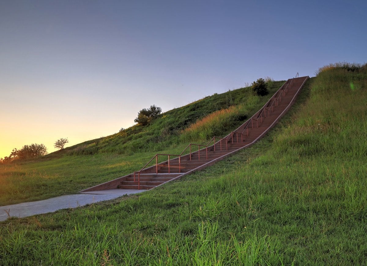
Want to learn more about the North America that existed before European settlers arrived? Head to Cahokia Mounds State Historic Site in Collinsville, Illinois. This Midwestern treasure, the largest archaeological site north of Mexico, showcases remains of the ancient Mississippian culture.
Sequoia National Park in California

A visit to the stunning forest filled with giant trees is a reminder that Mother Nature has forged on for thousands of years. The park’s notable attractions include Mount Whitney, the World’s Largest Tree, and Tunnel Log.
Selma, Alabama

From the National Voting Rights Museum to the Edmund Pettus Bridge, symbols of the struggle for civil rights are plentiful in Selma, Alabama. Consider driving the 54-mile Selma to Montgomery National Historic Trail, which traces the path of the 1965 protest marches for African American voting rights.
Highway One in California
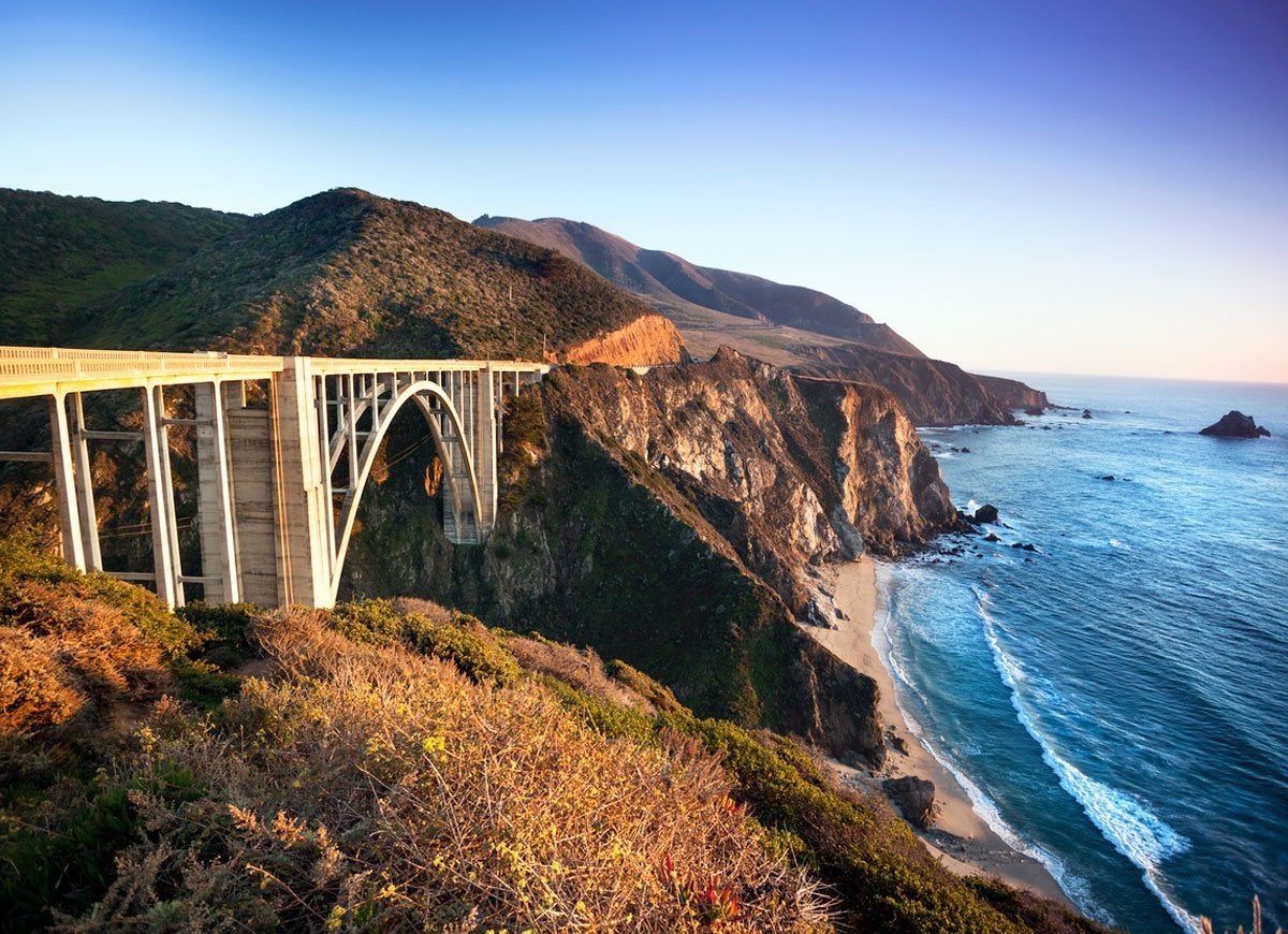
In the mood for a road trip? Take a drive on Highway One, which stretches along the rocky Pacific coastline from Dana Point to San Francisco and beyond. The 655.8-mile road offers prime access to iconic California sites that include downtown Los Angeles, Venice Beach, Hearst Castle, the Bixby Creek Bridge in Big Sur, and the Golden Gate Bridge.
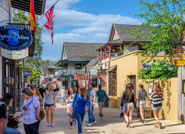
St. Augustine, Florida

Founded in 1565, St. Augustine is the oldest city in the United States. Visitors can explore relics of the city’s Spanish roots, such as the Castillo de San Marcos, a 17th-century fortress, and the Oldest Wooden Schoolhouse. If you prefer outdoor adventures, check out the beaches at Anastasia State Park for swimming, fishing, hiking, canoeing, and kayaking.
The French Quarter in New Orleans

New Orleans is a cultural and musical mélange known for its annual Mardi Gras festival, vibrant nightlife, and traditional Cajun cuisine. Start your tour in the historic French Quarter and enjoy famous restaurants, unique architecture, classic hotels, and lively Bourbon Street.
Related: State Pride: 50 Ways to Show You Love Where You Live
Acadia National Park in Maine
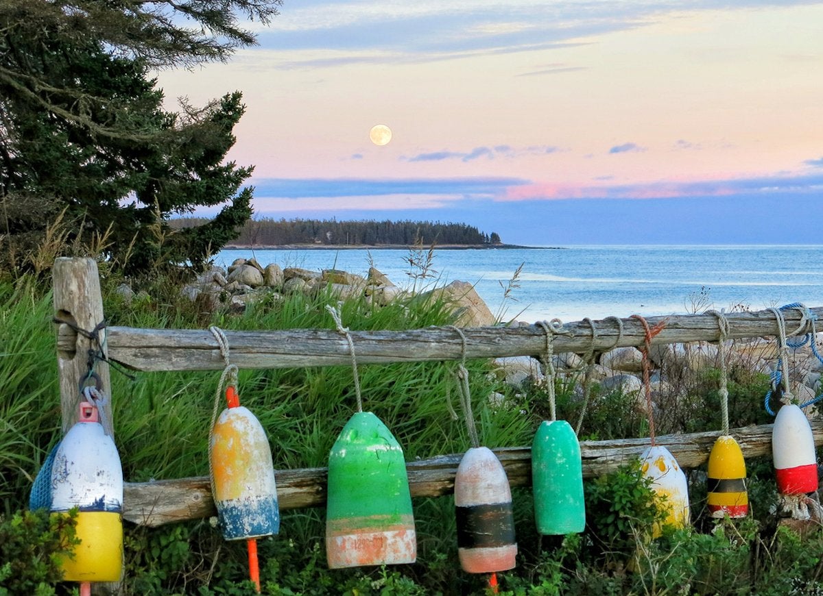
Acadia National Park doesn’t get the same attention as other U.S. National Parks, but it’s well worth the trip. Stay in the tiny nearby town of Bar Harbor and take a drive through the park via its paved loop road. Head there in October to get a spectacular view of the forest’s fall colors.
The Golden Gate Bridge in San Francisco

Dubbed one of the “Wonders of the Modern World,” the Golden Gate Bridge is a marvel to behold. The six-lane bridge is as impressive to drive across as it is to view from afar. Before it was put into operation in 1937, folks had to use a ferry to get across the body of water. Today, the bridge is a crossing for more than a 100,000 vehicles.
Salem, Massachusetts
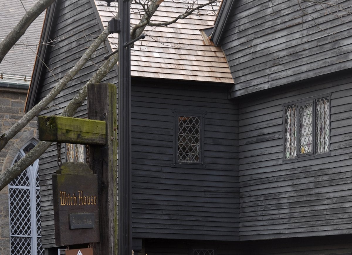
As it stands today, the city of Salem is both a reminder of a dark past and a spot that attracts numerous tourists each year. It’s home to multiple historic homes and attractions but is most famous for its witch-related haunts including a memorial that honors those executed during the infamous Witch Trials.
Ellis Island in New Jersey
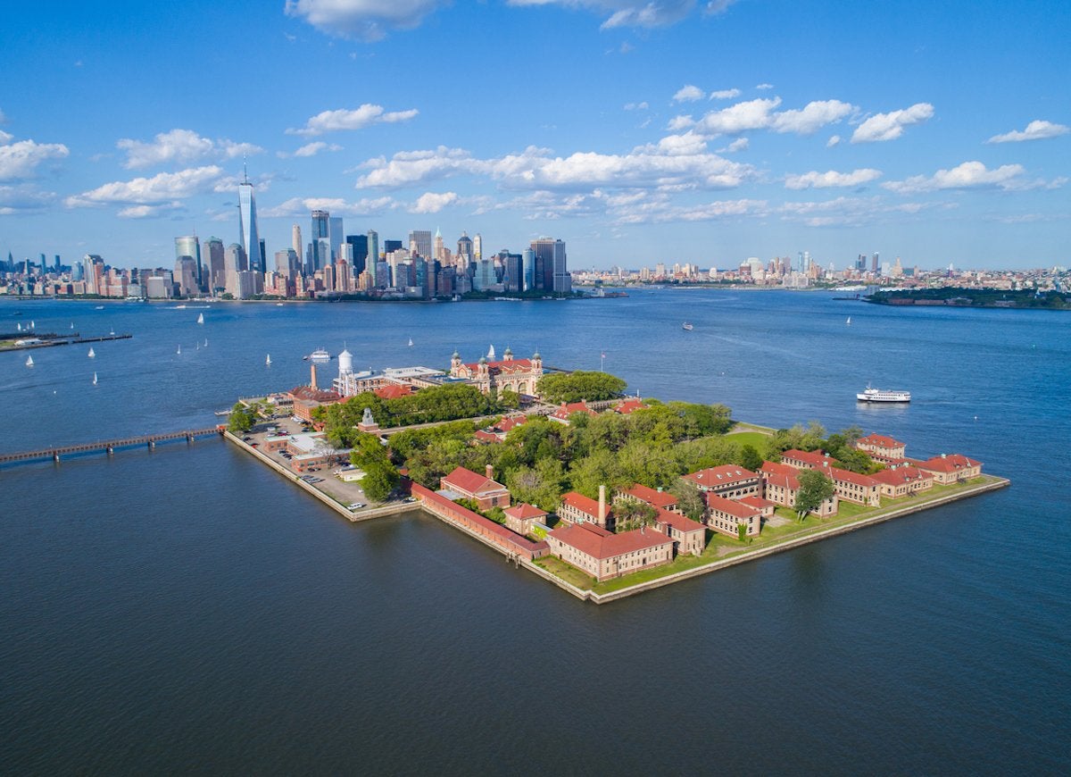
Ellis Island is where it all began for countless immigrants during the late 1800s and early 1900s. While the Statue of Liberty remains a notable attraction at this historic spot, the island also houses a museum of immigration.
Niagara Falls in New York
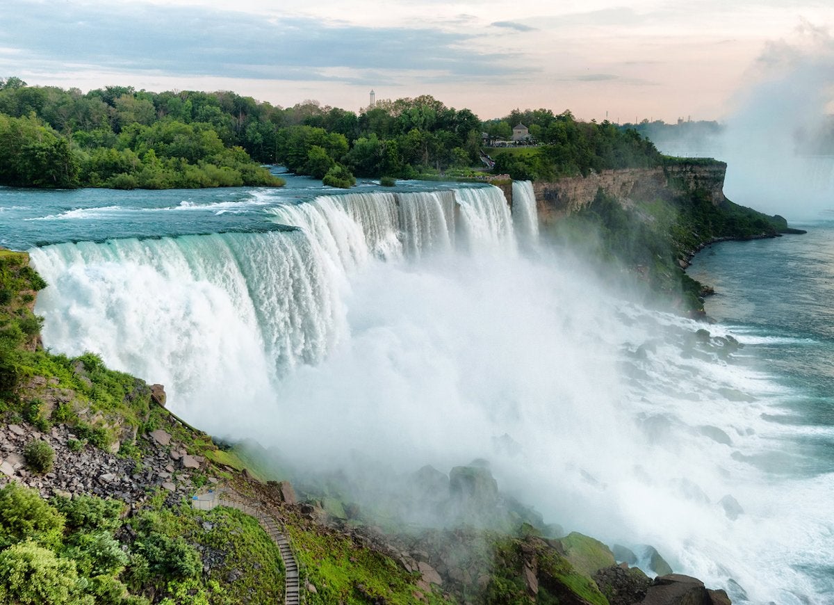
One of the most impressive natural attractions in North America, Niagara Falls straddles the border of the United States and Canada. Hop on a boat tour to get a closer look at the mighty falls, but don’t forget to wear a poncho!
Miami, Florida

Miami is more than celebrity yachts and flashy nightclubs if that’s not your scene. The vibrant city is made up of colorful neighborhoods each with its own interesting history and culture. Enjoy the Art Deco architecture in South Beach, taste the delicious food in Little Havana, and admire the eclectic art in Wynwood.
Santa Fe Art Colony in New Mexico

Wikimedia Commons via John Phelan
Under the turquoise skies of Santa Fe, New Mexico, you’ll find 250 galleries and hundreds of artists. This UNESCO-designated “Creative City,” which has a 400-year history, is home to the Georgia O’Keeffe Museum, loads of Spanish architecture, and the 2018 International Folk Art Market.
Related: 18 American Towns Every Old-House Lover Needs to See
Las Vegas Strip in Nevada

The 4.2 mile stretch of road is a spectacle worth visiting, especially at night. Even if you’re not much of a gambler, there’s plenty to do. Hit one of the nearby golf courses, go for a ride on the Big Apple Coaster, or check out a show at one of the Strip’s many clubs or lounges.
Independence National Historical Park in Philadelphia
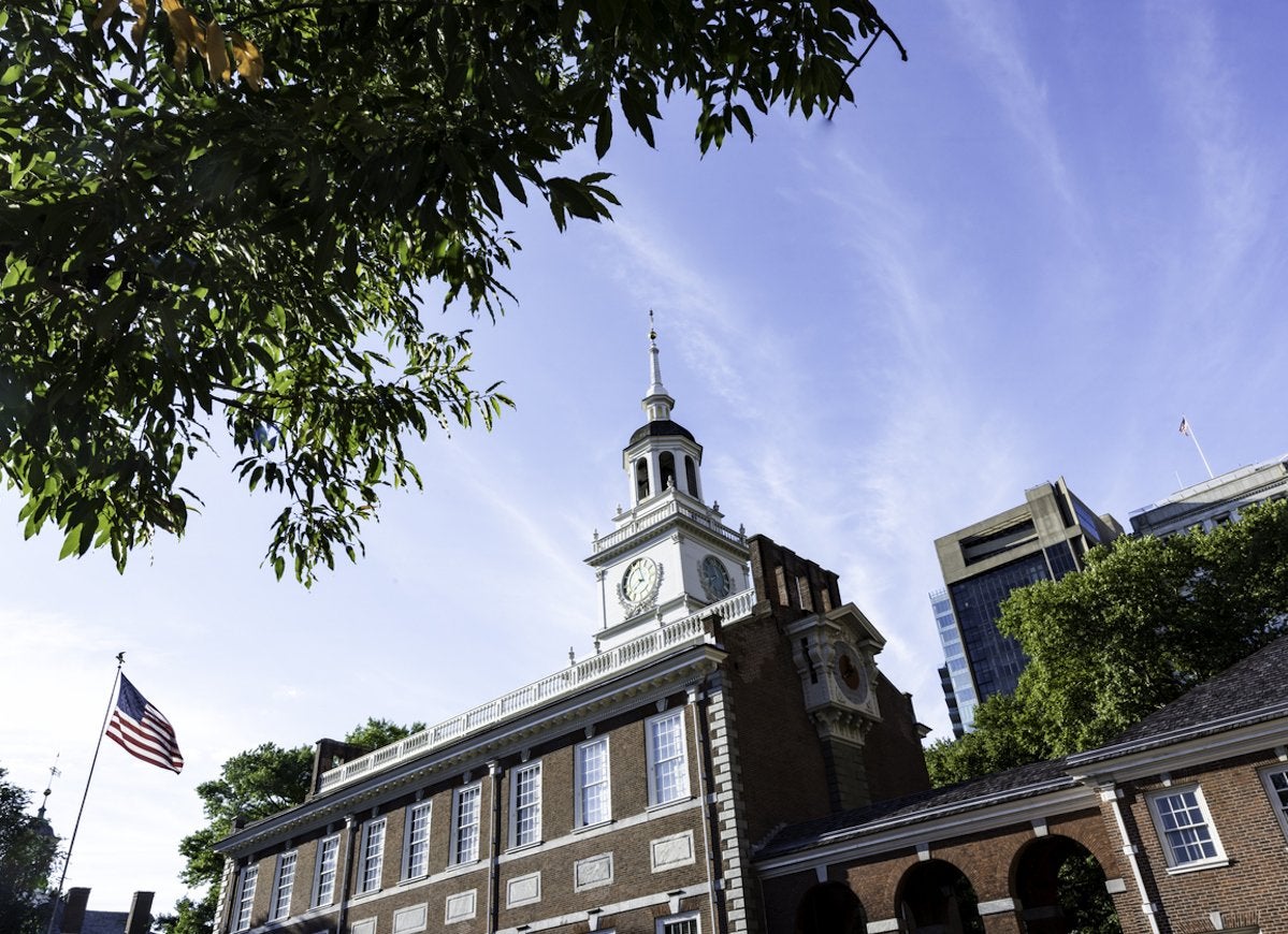
We’d be remiss if we didn’t include a trip to Independence Park on our list. It’s the birthplace of the U.S. Declaration of Independence and Constitution, after all! The location is also home to the Liberty Bell and is one of the most historically dense areas in the entire United States thanks to its abundance of landmarks.
White Sands National Monument in New Mexico

One of the most alien landscapes in the United States, the White Sands National Monument is a stunning display. The desert landscape is made up of gypsum crystals, and the unique composition of the sand makes it possible to walk upon it barefoot even during the hottest parts of the day.
Hawaii
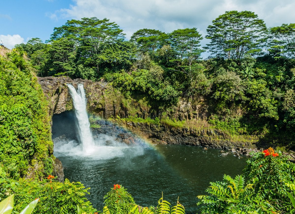
If you’re making the trip to Hawaii then you should explore as much of it as possible. Visit the islands for jaw-dropping tropical landscapes, volcano tours, outdoor adventures, and history of the Native Hawaiian culture.