
We may earn revenue from the products available on this page and participate in affiliate programs. Learn More ›
Planning a vacation for any season or region takes lots of mental gymnastics. Optimizing travel can be difficult if you aren’t familiar with the area, but there’s an assortment of online tools that can help you decide which time of year, location, and routes are best to travel to: nature trackers.
From hummingbird migrations to wildflower super blooms, consulting these nature-tracking maps may help inform your itinerary and make it a trip to remember.
RELATED: 6 Surefire Ways to Attract Hummingbirds to Your Yard
1. Interactive Hummingbird Map

This map is essential for those who want to know when the most hummingbirds will be in their area, as well as for any avid birders who want to plan an entire trip based on the little bird’s movements. Like many types of birds, most hummingbird species migrate south in the winter, so their northward journey in spring and summer is observed by many bird enthusiasts. This interactive map from Hummingbird Central shows the migratory patterns of hummingbirds, whether you want to plan a trip or make your hummingbird feeder a destination.
2. Rocky Mountain Snow Report

The Rocky Mountain Snow Report by On The Snow comes in handy for skiers, snowboarders, and all kinds of lovers of winter wonderlands. Each day during winter, popular ski resorts in the Rocky Mountain region report their snow depth, weather conditions, and other info that travelers can consult when determining which mountain has the best snow on any given day.
3. Skagit Valley, Washington Tulip Tracker
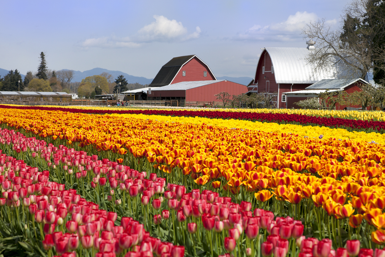
Skagit Valley is a region in Washington known for its abundance of tulips. Each spring, local farms enter the Skagit Valley Tulip Festival. Visitors can stroll through these farms to witness the incredible tulip blooms the region has to offer, and the festival’s interactive map (via Traveling Tessie) is helpful for participants to plan out their tulip trip.
4. Texas Wildflowers and Bluebonnets

The Lone Star State boasts an incredible array of native wildflower fields each year, but knowing where to find the best views is tricky. The Lady Bird Johnson Wildflower Center at the University of Texas hosts plenty of resources for Texas wildflower chasers. From premade road trip itineraries to detailed growing season information to bluebonnet field locations, this is the hub for those wanting to discover the beauty of native Texan flora.
5. Whale Watching Map

Responsibly observing wildlife in their habitat is a surreal and rewarding experience. Known for their predictable migratory patterns, whales are stunning creatures worth planning a trip around. WhaleMap is an interactive map that shows where whales may be traveling at any given time around North America, so travelers headed to the coast can plan their whale watching excursions ahead of time. Before booking, be sure to search for ethical whale tours and always prioritize the safety and wellbeing of these magnificent animals.
6. Fall Foliage Map
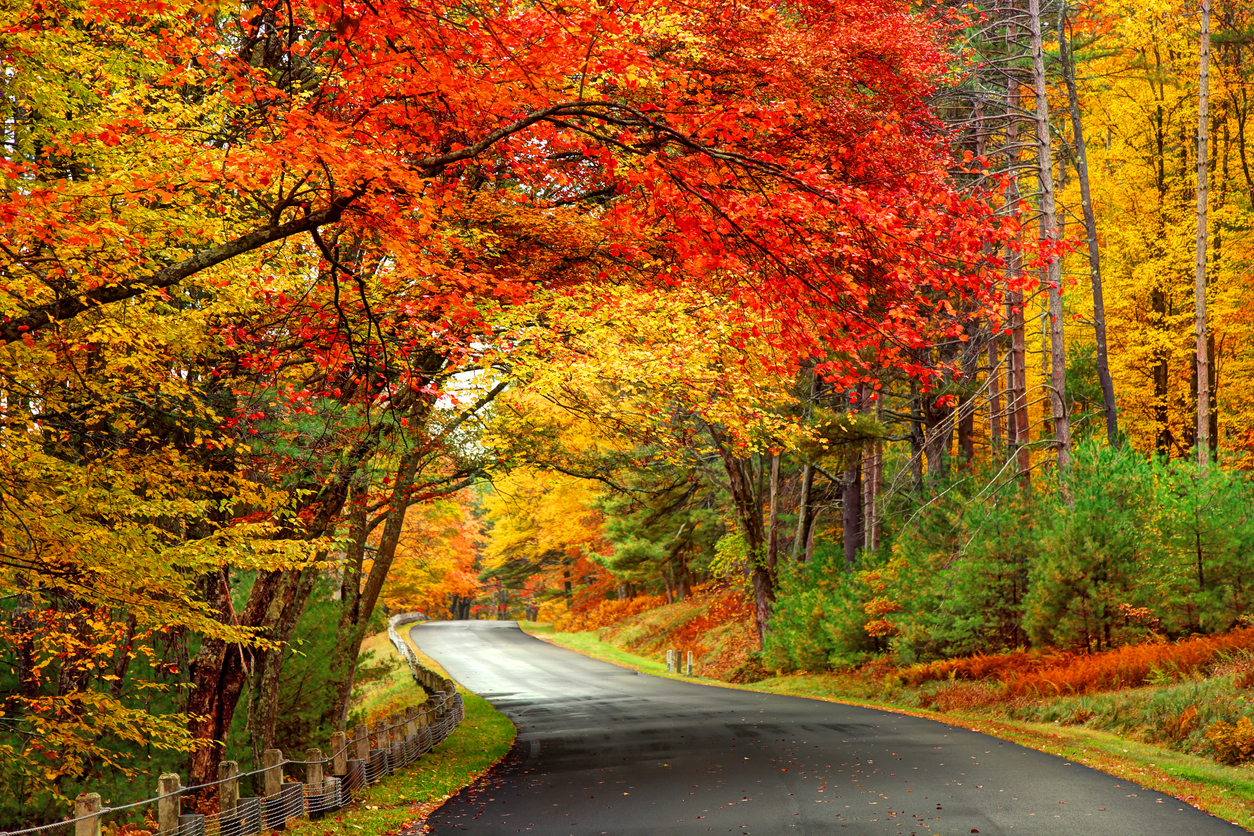
Autumn is known for cozy days indoors, football tailgates, and seasonal treats. But no fall season would be complete without the stunning changes that foliage goes through. Consult the Great Smoky Mountains National Park’s fall foliage map to know when the leaves are at their most vibrant across the U.S. In clever hands, this map can even be helpful for those making preparations for fallen leaves and readying their lawns for winter.
RELATED: Mulching Leaves: Why Mowing Leaves is Better Than Raking Them
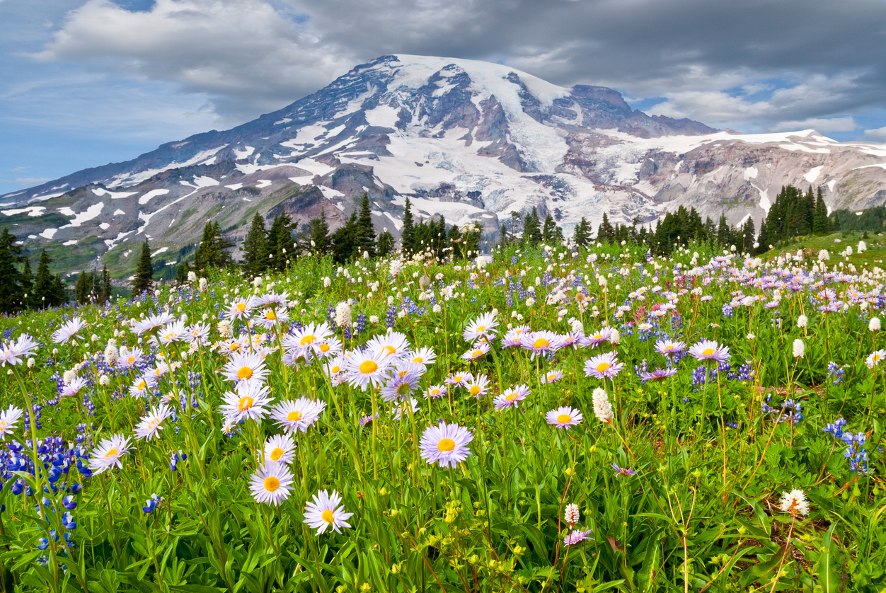
7. Pacific Northwest Wildflowers
The Pacific Northwest is well-known for its beautiful natural scenery. Mountains, coastal views, and, of course, wildflowers make for a stunning landscape. This Pacific Northwest Wildflowers map shows where, when, and what kind of flowers are at their peak blooms in Oregon and Washington. It also includes extra features, such as hiking trail recommendations and maps that lead hikers to popular landmarks.
8. Status of Spring
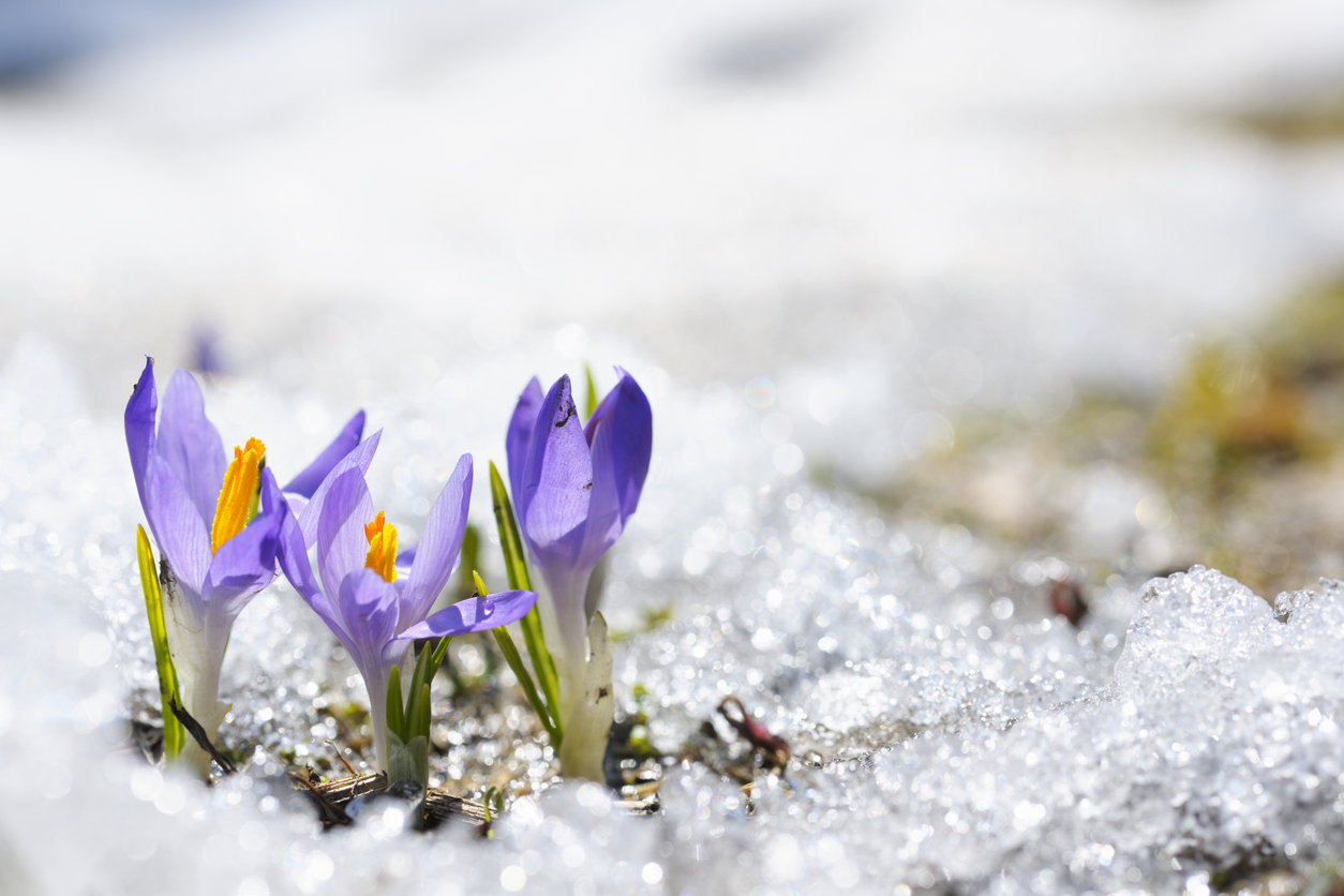
After a long and cold winter, it’s normal to anticipate springtime with excitement. These maps from the National Phenology Network give you some good weather to look forward to by estimating the start of springtime across regions. These maps may help inform bloom indexes and compare the normalcy (or unprecedentedness) of conditions to years past. When deciding what to buy for spring lawn care or planning an early spring sightseeing trip, this map is helpful and user-friendly.
9. Wildfire Trackers

The damage wildfires cause is a massive concern for homeowners and travelers alike. This hub created by the National Interagency Fire Center is home to several interactive maps that show active wildfire locations, drought risks, and risk assessments across North America. A testament to their value and reliability, the featured maps are created using data collected by agencies like NASA, the U.S. Forest Service, and National Oceanic and Atmospheric Administration.
10. National Park Maps

Planning a visit to any of America’s national parks requires a deal of preparation. Luckily, the National Park Service provides maps for over 400 national parks so visitors are always in the know. From campsite locations, hiking trails, and scenic road trip routes, the National Park Service provides enough information for visitors to have a successful trip to any national park.
RELATED: 14 Unusual Things to Do in America’s National Parks
11. Washington, D.C. Cherry Blossoms

The nation’s capital is home to a huge number of historic monuments and museums. It’s also home to some of the most gorgeous cherry blossom trees in the country. These trees’ pink blossoms bloom during a brief window in spring, and finding the best views is made easy with this D.C. Cherry Blossom Map. Visitors of the city can consult the map to find which neighborhoods have the best blooms or when specific cherry blossom tree varieties bloom.